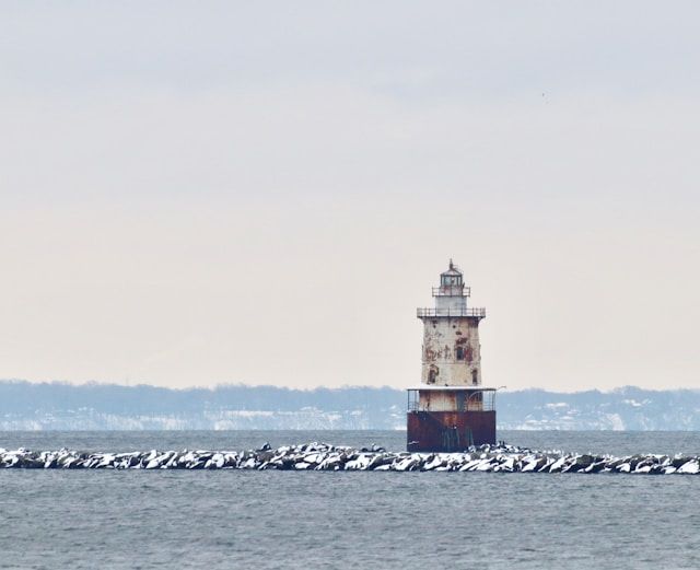
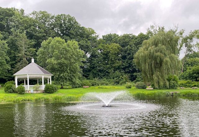
The Connecticut River has shaped Hartford‘s destiny since the city’s founding in 1635. Flowing for over 410 miles through four New England states, this longest river in New England became the lifeblood of Hartford, transforming it into a bustling commercial hub. The strategic location of Hartford, situated 45 miles upriver from Long Island Sound, allowed it to develop into one of the major cities along the Connecticut River while avoiding the navigational obstacles found at the river’s mouth.
Native Americans called it the “long tidal river,” and this waterway served as a critical transportation route long before European settlement. As Hartford grew, the Connecticut River functioned as a natural highway for shipping tobacco, manufactured goods, and agricultural products. The city’s relationship with the river runs deep – from the indigenous peoples who first navigated its waters to the colonial merchants who built their fortunes along its banks.
Get a discount of 15% to 70% on accommodation in Connecticut! Look for deals here:
Connecticut Hotels, Apartments, B&Bs
Today, the Connecticut River continues to define Hartford’s landscape and identity. Despite industrialization and changes in transportation methods, the river remains central to understanding the capital city’s history and development. Visitors to Hartford can witness firsthand how this powerful waterway carved not just the physical terrain of Connecticut but also its economic and cultural heritage.
Historical Significance of the Connecticut River in Hartford’s Development
The Connecticut River has been the lifeblood of Hartford since prehistoric times, shaping the city’s settlement patterns, economic growth, and strategic importance in New England. This “long tidal river” created the foundation for what would eventually become one of America’s oldest and most significant cities.
Early Inhabitants and Settlements
Before European arrival, the area around Hartford was home to several Native American tribes. The Podunk lived across the Connecticut River in what is now East Hartford, Glastonbury, and South Windsor. The Tunxis inhabited the west in the Farmington area.
These indigenous peoples relied on the Connecticut River for fishing, transportation, and agriculture. They called it “quinnetukut,” meaning “long tidal river” – a name that eventually gave the state its identity.
In 1635, English colonists established Hartford after Thomas Hooker led approximately 100 settlers from Massachusetts. The river’s fertile floodplains offered ideal farming conditions, while its waters provided transportation and power.
Nearby settlements of Windsor and Wethersfield formed what became known as the River Towns, creating the core of the Connecticut Colony.
Dutch Exploration and Colonial Impact
The Dutch were the first Europeans to explore the Connecticut River. In 1614, Adriaen Block navigated the waterway, opening the region to Dutch trading interests.
By 1623, Dutch immigrants established a trading post at the confluence of the Park and Connecticut Rivers. They built a fort called House of Hope to facilitate fur trading with local tribes.
However, the English soon dominated the area. Tension between Dutch and English settlers remained until 1654 when the Dutch were forced out of the region.
The river became a contested transportation corridor as both colonial powers recognized its value for moving goods, people, and information. Hartford’s position at a navigable point on the river made it naturally advantageous for trade and governance.
Strategic Role During the American Revolution
During the American Revolution, the Connecticut River served as a critical supply route. Hartford’s riverside location protected it from British naval attacks while allowing American forces to move troops and materials.
The river facilitated communication between revolutionary forces and enabled the transport of vital supplies manufactured in Hartford and Springfield. Shipbuilding along the river supported the colonial navy and merchant marine.
Hartford’s revolutionary leaders utilized the river to coordinate with other New England colonies. The waterway’s strategic importance was recognized by both American and British military planners.
Local industries supplied the Continental Army with weapons, uniforms, and provisions – all made possible by Hartford’s advantageous position on the Connecticut River.
Post-Colonial Expansion and Industrialization
After independence, Hartford’s connection to the Connecticut River drove economic growth. By the early 19th century, steamboats revolutionized transportation on the river, helping Hartford become a commercial center.
The river powered early factories and mills. Industrialization transformed Hartford’s riverside areas as manufacturing facilities, warehouses, and shipping operations expanded along the banks.
Insurance companies established headquarters in Hartford partly due to the river trade they could insure. The Connecticut River’s reliable transportation made Hartford an ideal location for banking and finance.
Bridges spanning the river connected Hartford to East Hartford, expanding the metropolitan area. By 1840, the river had been improved with dredging and channel markers to accommodate larger vessels.
The Connecticut River’s 410-mile length continued to serve as New England’s most important north-south waterway until railroads gradually diminished its commercial significance in the late 19th century.
Environmental and Geographical Evolution
The Connecticut River’s physical landscape has undergone remarkable transformations since the last ice age, profoundly shaping Hartford’s development and the surrounding region. These changes have created both opportunities and challenges for the people who settled along its banks.
Formation of the Connecticut River Valley
The Connecticut River Valley formed over 10,000 years ago at the end of the last ice age. As massive glaciers retreated northward, they carved out the valley and left behind a rich, fertile landscape. Before this glacial retreat, the area that would become Hartford was buried under ice nearly a mile thick.
The river itself changed dramatically over time. North of Middletown, the Connecticut River was once much narrower and deeper, with limited human activity along its banks. As sediment accumulated, the river’s flood plain thickened and rose at least 20 feet.
This geological process transformed the valley into stone-free meadowlands, perfect for agriculture and permanent settlements. Hartford’s location at a natural narrows in the river made it ideal for both crossing and controlling river traffic.
Natural Disasters and Their Impact
Floods have dramatically shaped Hartford’s relationship with the Connecticut River. Major flood events in 1936 and 1938 devastated riverside communities, prompting significant changes in how the city managed its waterfront.
The Park River, which once flowed openly through Hartford, was buried underground after repeated flooding threatened downtown. This massive engineering project fundamentally altered the city’s geography and its connection to its waterways.
Hurricane-driven flooding in 1955 led to the construction of the Connecticut River’s extensive dam and reservoir system. While these structures helped control flooding, they also changed the river’s natural flow patterns and ecosystems.
The tidal nature of the Lower Connecticut River continues to influence Hartford, as rising sea levels and more frequent storm surges push saltwater farther upstream than in previous centuries.
Conservation and Modern Challenges
Today, the Connecticut River watershed faces numerous environmental challenges. Water quality issues stem from historical industrial pollution, agricultural runoff, and urban development along tributaries like the Farmington and Hockanum Rivers.
Dam removal projects have begun restoring natural fish migrations through Hartford. Species like American shad, which once supported substantial commercial fisheries, are returning in greater numbers as river restoration efforts continue.
Climate change presents new threats to the river valley. Rising temperatures affect native species, while increased precipitation brings more frequent flooding to Hartford and other riverside communities.
Conservation organizations have preserved significant portions of the watershed between Hartford and Long Island Sound. These protected areas in towns like Cromwell, Haddam, and Middletown maintain the scenic beauty that makes the Connecticut River Valley one of the region’s most treasured natural resources.
Get a discount of 15% to 70% on accommodation in Connecticut! Look for deals here:
Connecticut Hotels, Apartments, B&Bs

